Understanding walkability and walking rates in Berlin: an urban form and street pattern comparison
Understanding walkability and walking rates in Berlin: an urban form and street pattern comparison / Alvaro Valera Sosa, Christine Nickl-Weller. – Die Psychiatrie (2016) V. 13 (Heft 2) 79-87 (9 p.) [formato PDF, 900 kB].
This descriptive study provides information indicative of the interaction between physical features of neighbourhood environments with health behaviours such as walking and biking which consequently affect disease rates related to lifestyle. Aim: Through a summary of systematic observations at two urban scales, the macro and meso-levels, a neighbourhood comparisonol. was realized in Berlin, Germany, to explore how urban forms and street patterns can support walking or biking, or not, despite seasonal variations, socio-economic status, cultural backdrop or individual decisions to walk. For this study, a conceptual evaluation framework was conceived and structured to assess secondary data from public databases, conveniently decreasing time and costs. Result: The framework and preliminary results of the work aim to be a significant endeavour in promoting transdisciplinarity among researchers and practitioners mainly from public health, architecture, urban planning and design fields.
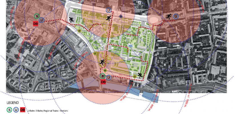
To explore how a neighbourhood built environment can support walking or biking or not, a comparison was realized between Karl-Marx-Allee Viertel, a highly car-dependent neighbourhood located in Alexanderplatz (Mitte District) and Boxhagener Viertel, a neighbourhood located in the Friedrichshain District which presents very high walking rates regardless of seasonal variations.